Public Access and Private Property: The Economics of Colorado River Access
Introduction
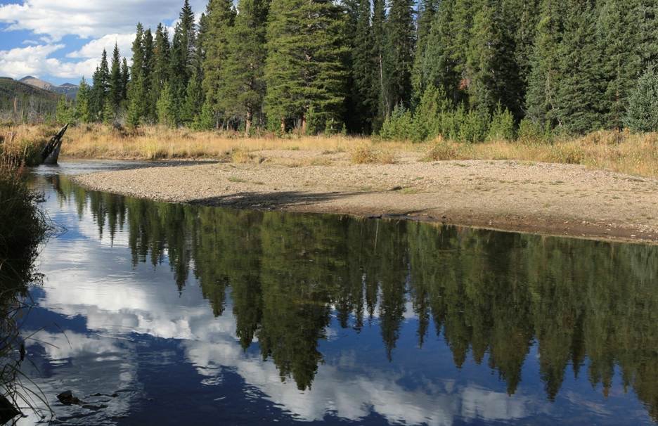
In 2005, stream mileage on the Elk River in Routt County sold for $2.9 million per mile. By the end of 2024, the same stream in the same area was selling for $4.7 million per mile. Colorado land is worth substantially more if it encompasses rivers, streams, or creeks. That is not specifically because of the value of the water itself – in fact the presence of a stream on one’s property does not necessarily convey the right to use that water. Rather, the value of streams crossing property in Colorado is often in the aesthetics, the calming sound of flowing water, the quality of life, enjoyment of nature, outdoor recreation, and the unwinding relaxation of flyfishing.
Although the value of land, and of the associated rivers and streams, varies considerably in different parts of the state and with different kinds of streams, land is clearly worth more when water flows across it – a lot more. Even the most cursory examination of land sales in Colorado demonstrates that people pay enormous sums for rural properties, and even more for properties with running water, millions of dollars for quality fishing and floating streams. And as the second report in this series documented, they also pay millions of dollars each year to maintain and improve those streams.
Every few years Coloradans face a renewed political debate about public access to these privately-owned streams, partly because various western states have different property laws regarding streams. In Colorado, the waters of the state belong to the people of the state, but the land under the streams belongs to the adjacent landowners. Access is not an issue on hundreds of miles of streams, because the adjacent landowner is the public – over a third of Colorado is federally owned and managed by the Bureau of Land Management, Forest Service, Fish and Wildlife Service, National Park Service, and Bureau of Reclamation. Many streams also flow through state lands, especially wildlife areas and state parks.
Still, there are many miles of streams that cross private land, and if legislators or voters want to change the law to make all floatable streams public land, the cost of purchasing those river miles could be in the billions. Many activists argue that such a change in the law should not be viewed as a “taking” of private property under the Constitution, and property owners take the opposite position. In this report, the authors do not presume to guess how such a legal morass may turn out. That could turn out to be a question for the judicial system, but there is very little doubt that such a significant change in the law, and in 150 years of legal precedents, would lead to expensive and prolonged litigation.
This report will examine the legal framework surrounding the issue of what constitutes private property, to provide context for the ongoing debate. First, it will attempt to inform the entire discussion by answering two fundamental questions: how much land and stream mileage would be involved, and how much is it worth?
Key Findings
A large share of Colorado’s rivers and streams run through private land
- CSI estimates that 55,000 to 65,000 of Colorado’s 107K – 110K river/stream miles are on private land, including roughly 20,000 to 30,000 miles of named rivers and streams and about 1,375 to 1,700 miles that are realistically floatable.
Private river and stream adjacent properties are worth billions in Colorado
- Stream sales from 2007 to 2024 ranged from about $500,000 to $5.9 million per mile, averaging just under $2 million.
- The 1,375 – 1,700 estimated floatable private river/stream miles alone are worth roughly $2.75 billion to $3.4 billion, with the true total value potentially far higher.
River access often drives most of a property’s value
- Appraisals frequently attribute 50% to 85% of total property value to the river itself, including one particular Yampa property sale where the river accounted for 87.2% of total value.
Even limited loss of exclusivity can sharply reduce value
- On Tarryall Creek, a limited private fishing easement reduced river value from about $850,000 per mile to $300,000 per mile, implying a property value loss of about 65%.
- On that same Tarryall Creek property, moving from restricted private access to unrestricted public access was estimated to cut total value from nearly $1.6 million to about $407,000 in 2018, a decline of nearly 75%.
Changing Colorado law would likely trigger takings claims
- Colorado has never declared a river navigable, and the Colorado Supreme Court ruled in People v. Emmert that streambeds and banks are private property.
- Any expansion of a right to float or wade would require a complex, contentious and costly process to determine navigability.
- Any determination of navigability would face immediate constitutional takings litigation because it would reduce a longstanding right to exclude while also devaluing individuals’ property.
- If non-floatable miles of private waters were also implicated in a “takings” settlement, the cost to the state could be in the tens of billions or more.
How Much is Stream Access Worth?
Miles of Privately Owned Streams
There are 55,000 to 65,000 miles of rivers and streams in Colorado – over half the statewide total – that are on private land. Roughly half those miles are in rivers large enough to be named, and at least 1500-1700 miles can be considered generally “floatable” at least part of the year.
No existing database makes that calculation simple. Estimating the number of miles of rivers and streams on private land in Colorado is necessarily an approximation, but perhaps a reliable one with the right methodology. The lengthy process needed to determine exact numbers would require combining hydrography datasets with land-ownership maps. A completely accurate GIS analysis would have to map every floatable segment of every river statewide and then overlay detailed parcel ownership boundaries to count the miles that fall inside private parcels. There is no such database in Colorado, and the cost and time to create it would be prohibitive. However, a reasonable estimate is possible.
Colorado’s total stream and river mileage is generally understood to be between 107,000 and 110,000 miles (from the U.S. Geological Survey’s National Hydrography Dataset, including both perennial and intermittent streams – those which flow year-round vs. only seasonally). That includes everything from major rivers to small headwaters creeks.
That U.S. Geological Survey (USGS) dataset can be overlaid with land ownership data from GIS layers that show private parcels, federal lands, state trust lands, and tribal lands. This process is used regularly by the Colorado Water Conservation Board, Natural Heritage Program, USGS, and private groups like Trout Unlimited.
That process has variables, too, but it is commonly estimated that 50 to 60 percent of Colorado’s rivers and streams flow on private land. That translates to roughly 55,000 to 65,000 miles of rivers and streams on private land. Other general assumptions can be made, for example, that headwaters are most often on higher-altitude public lands, but valley bottoms are overwhelmingly private land. That’s because farms, ranches, and towns historically settled along rivers, not in the high mountains.
Next, we limited this analysis to perennial streams, not intermittent streams, because the latter are floated for recreation much less often, if at all. We looked only at named rivers (those listed by USGS in the Geographic Names Information System), another way to narrow the analysis to those streams commonly floated or where there is a desire for public access. Finally, we only focused on floatable reaches of those named rivers and streams, to the extent that can be determined.
In other words, we wanted to estimate floatable, named river miles in Colorado, meaning stretches of rivers long enough and large enough that they’re commonly floated or rafted by the public using canoes, rafts, kayaks, and tubes, and are significant rivers rather than tiny creek fragments. It is not a perfect number because conditions vary widely by season and river segment (especially the amount of flow and ease of access), and some named rivers are floatable in some reaches but not all.
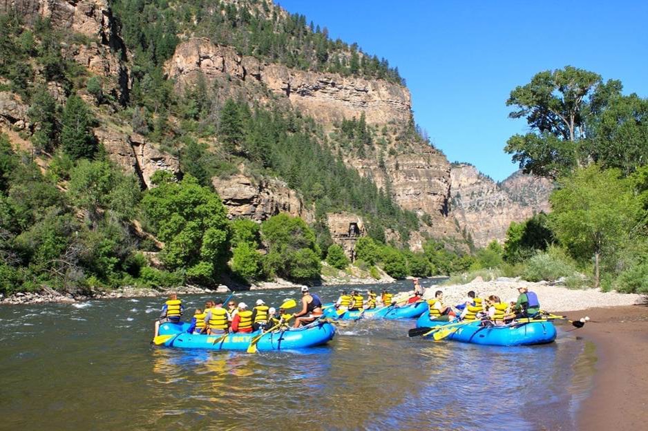
Rafting in Glenwood Canyon
These are the named rivers and major tributaries in Colorado that are most commonly floated, along with a rough estimate of their floatable miles:
- Colorado River, about 300 miles of floatable reaches from near Kremmling to the Utah border.
- Gunnison River, floatable below the Aspinall Unit dams, about 80-100 miles.
- Taylor River, 40-48 miles.
- Yampa River, about 130 miles.
- Dolores River, 70-90 miles.
- Animas River near the state line below Durango, about 60-70 miles.
- San Juan River (Colorado portion only), about 30-40 miles.
- Piedra River near Navajo Reservoir, 30-40 miles.
- Crystal River, 25-35 miles (though low water is common).
- Roaring Fork River, 30-40 miles between Basalt and Glenwood Springs.
- Arkansas River, 150-180 miles, the most floated river in the U.S.
- South Platte River, 80-120 miles, especially upstream from Littleton.
- Cache la Poudre River, 50-70 miles including Poudre Canyon.
- Clear Creek, 40-55 miles west of Denver, and in some calm eastern reaches.
- Blue River, 40-60 miles downstream from Silverthorne/Frisco.
- Big Thompson River, 25-40 miles.
- Huerfano and Cucharas Rivers, 30-50 miles, occasionally floatable during good flows.
- Rio Grande River, about 70 miles.
Note that Colorado does not publish an official estimate of floatable river miles, nor is there any single source of that data. The above estimates synthesize information from the USGS National Hydrography Dataset, American Whitewater’s inventory of runnable river segments, and state and federal land ownership data. Those assumptions result in total estimated floatable named river miles in Colorado of about 1,200 to 1,500 miles. We considered this range rather than an arbitrary number because floatability depends on water levels (many segments are floatable during spring runoff but not during late summer and autumn low flows), and sometimes on seasons (some rivers like the Dolores and Crystal are only reliably floatable for part of the year).
That estimated range includes named rivers with notable recreational float sections, but not every small named creek or ephemeral channel (there are over 150 named rivers in Colorado). Not all named river miles are floatable everywhere or by everyone (some are floatable by kayaks or rafts but not boats, for example). Also, many rivers have more than one floatable section, sometimes separated by rapids or access problems. And as we have seen throughout this series of reports, public access and private land issues often limit realizable float mileage even if the river is technically floatable.
This is where a landownership pattern-based methodology would lead in the wrong direction. It begins with the question, how many of those 1,200-1,500 floatable miles are on private land? Colorado has never done a statewide floatability classification or mandated any kind of reporting, so an estimate might begin with Colorado’s land ownership mix. Roughly 57% of Colorado’s land is privately owned, 36% is federal public land, and the remainder is state or local public land. Because the major headwaters of rivers are often on public lands (national forest, wilderness areas), and the rivers then flow into valleys where private ranches and farms, and nearly all cities and towns, are more common, much of the floatable sections end up crossing both public and private lands.
Headwaters of the Colorado River, Grand County
Beginning with the estimated 1,200–1,500 floatable river miles along named rivers in Colorado, one might estimate that if 57% of Colorado’s land base is private, and if floatable stretches generally follow land ownership patterns, then about 40–60% of floatable river miles in Colorado flow through private land. However, assuming floatable rivers interact with private lands roughly in proportion to overall private land ownership would be a mistake. In fact, we know the vast majority of floatable miles are at the lower elevations where rivers are larger, not at high altitudes where they have their headwaters in small intermittent creeks. So, basing this estimation on a methodology connected to land ownership patterns does not provide an accurate baseline, and probably underestimates the private ownership of floatable miles considerably.
To get a more reliable estimate, a more detailed methodology was needed. Beginning with the estimated 55,000 to 65,000 miles of rivers and streams in Colorado that are on private land, how different might that number be if it excluded unnamed minor creeks? That exclusion reduces the number of total miles by more than half, and the number of privately owned miles significantly. Consider that Colorado’s 107,000–110,000 total stream miles (USGS NHD) are heavily dominated by small, unnamed headwater trickles, intermittent and ephemeral channels, and short tributaries with no official name in the Geographic Names Information System (GNIS). Nationally (and in Colorado-specific basin studies), the breakdown typically shows about 60-70% are unnamed, minor creeks (what USGS calls 1st and 2nd order streams), and about 30-40% are named tributaries and rivers.
That explains why major rivers like the Arkansas, Colorado, South Platte, and Gunnison include long stretches through private land in valleys, why medium named tributaries like the Roaring Fork, White, and Animas are often mostly private below national forest boundaries, and why small unnamed creeks are mostly public headwaters, many of which never reach private land at all, and most of which are not floatable. No wonder almost all stream-access conflicts involve named rivers, and why recreation, fisheries, and water-law debates rarely involve unnamed creeks.
We used that more accurate estimate of the number of stream miles that are in named tributaries and rivers (excluding minor unnamed creeks). That gives us a number for named stream miles based on 30-40% of the state’s 110,000 total miles, or roughly 33,000-44,000 miles of named rivers and streams. As noted above, these named river segments are disproportionately valley-bottom, agricultural, and near settlements, meaning a preponderance of private land. So, the private-land share is higher for named streams than for all streams, estimated to be 55–65% of named river miles.
Using those ranges, a low-end estimate (55% of 33,000 miles) is 18,000 miles, and a high-end estimate (65% of 44,000 miles) is 29,000 miles. The best working range, then, is that 20,000 to 30,000 miles of named rivers and streams in Colorado are on private land. Thus, we used the mid-range number of 25,000 miles for purposes of this analysis.
Finally, we attempted to determine how many of those 25,000 miles can realistically be considered floatable. A “floatability” filter is needed to know how many of the privately owned named river miles are realistically floatable by small craft (rafts, kayaks, canoes, tubes) at least part of a typical year. Floatability reasonably means not whitewater-only, not expert-only, but sustained channels with adequate width and depth at seasonal flows, reachable in reality not theory, and even typically listed in various boating guides, American Whitewater runs, or state recreation materials. That generally excludes steep headwaters forks, very short named creeks, and channels fragmented by culverts, diversions, or dry reaches.
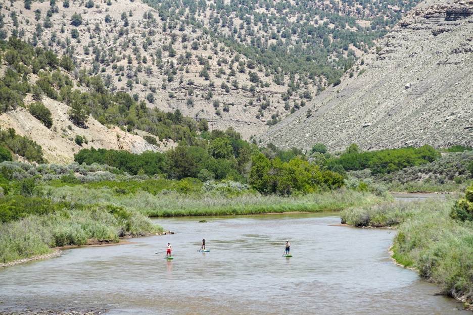
Floaters on the Colorado River near Rifle don't always need boats or rafts
Based on American Whitewater inventories, state boating guides, known paddling patterns in Colorado, and the fact that most named streams are still small tributaries, we believe a defensible range is that 4–7% of named river/stream miles in Colorado are floatable. So, applying a mid-range 5.5% “floatability” filter to the 25,000 miles of named rivers on private land gives us a reasonable estimate that about 1,375 miles of floatable rivers are on private land.
That implies that a majority of Colorado’s floatable river miles cross private land at some point, not necessarily continuously, but materially.
We believe this estimate matches land-ownership patterns in those areas (private valleys, public headwaters), and matches observed floating reality (most floats occur downstream of national forest boundaries). It also avoids what we think would be two significant analytical errors: counting every wet channel as “floatable,” and treating public ownership as dominant just because most headwaters are public. In fact, private ownership is dominant in many river basins.
Finally, it is noteworthy that the percentage of floatable river miles on private land varies widely between river basins in Colorado. Still based only on 1) named rivers and streams, 2) private land segments, and 3) the realistically floatable filter, we point out that:
- Roughly 60% of the Colorado River and its major tributaries meet those criteria.
- The Arkansas River Basin is less, roughly 28% that meets all three criteria.
- The Platte River Basin is only 12% named, private, and floatable.
- The two latter rivers have fewer floatable miles, as a percentage, because both have the majority of their mileage in the farmland of the eastern plains, not in the mountains.
Understood differently, floatable miles are not proportional to land area, but instead driven by river size, continuity, gradient, and other hydrologic factors. About 55-60% of the Colorado River Basin miles cross private land, as do 45-55% of the Arkansas Basin miles, and 70-80% of the South Platte Basin miles. The Colorado River Basin alone contains more private-land floatable miles than the Arkansas and Platte basins combined, considering river length, valley ownership, and agricultural settlement patterns. If we widen the assumptions even slightly, by including seasonal reaches and high-water-only runs, the total could quickly increase from 1,375 miles, perhaps closer to 1,700 privately owned and sometimes-floatable miles.
It is acknowledged that this estimate, based on a reasonable and defensible methodology, may still not completely address the political/legal question in Colorado, because advocates for the right to float/wade may not be content merely accessing mileage we determined to be “floatable.” If any legislative effort were to insist on public access to all mileage that is “wadable,” whether or not “floatable,” then the potential cost could apply to the entirety of the estimated 55,000 to 65,000 miles of rivers and streams in Colorado that are on private land.
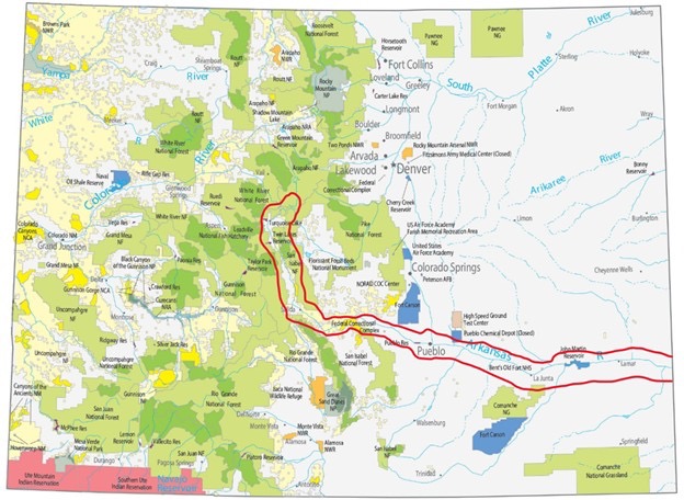
Case Study – the Arkansas River
The Arkansas River is in many ways a microcosm of the political issue in Colorado, because it flows through national forest, BLM, State Parks and Wildlife Areas, and private land. It has also been the source of several landowner-floater conflicts over the years. But it merits an additional analysis in the context of public access, because it is the most popular floating stream in the United States, with 250,000 to 800,000 people rafting, kayaking, inner-tubing, and otherwise floating between Leadville and Pueblo annually.
Browns Canyon on the Arkansas River
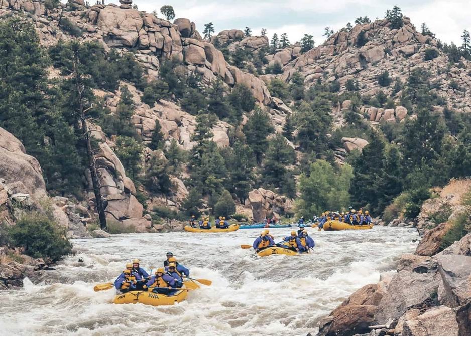
That is partly because the river’s proximity to Front Range population centers makes it easily accessible for most Colorado residents and visitors, and partly because the stream itself is so diverse that it appeals to floaters of every skill level. Rafters generally classify streams on a difficulty scale from I to V, and at various times of year the Arkansas has segments in all five classes. There are numerous commercial rafting businesses and boat ramps along the river, as well as a constructed kayak park in Salida.
The Arkansas also attracts thousands of anglers, as it includes the state’s longest designated stretch of Gold Medal fishing waters, a segment over 100 miles long between Parkdale and the Lake Fork confluence near Leadville. It is notable that the Gold Medal designation from Colorado Parks and Wildlife (CPW) does not always make river mileage more valuable, as there are many other factors. Some of the highest valued river mileage sales in Colorado have been in stretches of the Fryingpan, Blue, Yampa, Elk, and Taylor Rivers, none of which enjoyed the Gold Medal designation. As with all real estate, location remains the primary value-adding factor. The Poudre, Big Thompson, St Vrain, South Boulder Creek, Clear Creek and Tarryall Creek all show extremely high values primarily because of their location near the main population centers.
The Arkansas is also home to the Arkansas Headwaters Recreation Area, a linear state park 152 miles long whose popular activities include camping, hiking, picnicking, wildlife watching, mountain biking, rock climbing, gold panning, and especially fishing and rafting. It encompasses 27 state wildlife areas and public fishing easements.
The state park designation has led to increased public use of the Arkansas, as well as considerable public investment in boat ramps, fishing access, term leases, and perpetual access easements. Those investments have further increased public use and popularity, and in some cases led to increased conflicts because there are still significant private holdings there. For example, in the 57-mile stretch between Leadville and Salida there are approximately 41 miles of public water but also about 16 miles that cross private land. Between Leadville and Granite there are an estimated 15 miles of public water but also 5 miles of private, and from Buena Vista to Salida roughly 20 miles of public water but 8 miles of private.
On those private lands, as with so many others around the state (as detailed in Report 2), there have also been considerable investments in habitat improvement by those landowners. One owner in the “11 Mile Reach” between California Gulch and Two-Bit Gulch, working closely with CPW officials, estimated the cost of river improvements at $465,000 per mile.
Finally, the California Gulch Superfund Site restoration work since 1983, and a water treatment plant installed in 1992, have improved water quality significantly for many miles downstream, further increasing the value of associated river mileage. The upstream reservoirs and the associated flow management agreements were designed to improve both fishing and rafting, which benefits both private and public users, but also works only because of the participation of the landowners who are also water rights owners. In other cases, the private owners there are both beneficiaries and significant funders of the ongoing river improvements.
The Arkansas River is not legally different in the context of stream access laws. Rather, it is the subject of so much discussion and controversy simply because it is more heavily used, closer to the Front Range, and involves more administrative agencies than almost any other stream (EPA, Forest Service, BLM, Fish and Wildlife Service, Corps of Engineers, CPW, CWCB, eight counties and at least a dozen cities).
It also helps illustrate the methodology we used in determining a range of values for private river miles in the state, because more than 150 miles of the Arkansas in Colorado are between Pueblo and Kansas, nearly all of it private land except a few state school sections, all of which are also privately managed under agricultural leases. There is very little public interest in floating those eastern plains sections, compared to the extreme popularity in the higher-elevation areas. That explains why, for purposes of this report, we chose to limit our river mileage value estimates conservatively, to rivers that are both private and realistically floatable.
Red outline shows the Arkansas River mainstrem, most of it on private land (white areas). Forest Service and BLM lands in green and yellow.
The Value of Those Streams
Floatable streams on private land are tremendously valuable in a state where water is so scarce. Such waterways sell for millions of dollars per mile, and the aggregated statewide value of privately held streams and rivers is in the billions. CSI estimates the value of private “floatable” streams alone in the range of $3-5 billion, and of all private rivers and streams probably closer to $100 billion.
Those numbers matter because of the perennial debate about public stream access. If it is determined that changing Colorado’s laws to provide a public right to float/wade constitutes a compensable “taking” under the state and federal Constitutions (see legal analysis in the next section), then it should be understood what that value might be. We do not venture a guess on future court rulings, but policy makers considering the issue should at least be aware of the potential expense of such “takings” cases.
When appraising properties in Colorado that encompass rivers and streams, professional appraisers routinely add stream value to the value of land and improvements. They use comparable sales to create a formula for assessing stream value in a particular area or on a particular stream. Those values in the past few years (2007-2024) have ranged from a low of $500,000 per mile to a high of $5.9 million per mile (excluding high and low outliers).
During that period the research tracked 91 sales in streams across the state: the Cimarron, Gunnison, Eagle, Yampa, Elk, Dolores, Colorado, Poudre, Big Thompson, Little Snake, Big Laramie, Lake Fork, Arkansas, Blue, North Platte, Taylor, Smith Fork, Canadian, Encampment, and Michigan Rivers. The average during that period across all basins was just under $2 million per mile ($1,988,889).
To illustrate the variability of the numbers, one need only note the variability of the property and river conditions. Streams with greater flows are generally more valuable than smaller ones, and rainbow and brown trout streams are generally more valuable than brook trout streams, because brook trout are smaller and tend to inhabit smaller and higher-altitude streams. Streams with regular public floating are less valuable than those where public access is difficult. Properties farther away from the Denver area are often less valuable, hence mileage on the North Fork of the Gunnison may be worth less than half as much as on the Blue River ($1.5 million a mile vs. $3.3 million). Waters with state stream gages are preferable, since greater flows are worth more. For example, property downstream from Stagecoach Reservoir has sold for over $6 million per mile because the reservoir itself enhances year-round flows, while similar properties above the reservoir, where flows are more intermittent, have sold for about a third that amount.
For most property owners, though, it is the condition of the fishery that is most decisive in determining value. State officials often measure that by pounds of trout per mile, which allows an objective comparison between streams. One appraisal report explained, “For example, one might have a stream with 2,000 brook trout per mile, but the majority of them are small, fingerling-size fish. This stream might have 40 pounds of trout per mile (a low classification). Another stream might only have 500 brown trout per mile, but their average size is 12 inches and there are 750 pounds of trout per mile (a very high classification).” Since anglers prefer the latter stream for fishing, its per-mile value is considerably higher.
Further, streams designated as “Gold Medal” fisheries by the state often have higher value, such as those in the upper South Platte, Taylor, North Platte, and Roaring Fork Rivers. That designation means the stream regularly produces a standing stock of at least 60 pounds per acre and at least a dozen trout that are 14 inches or longer per acre, over at least a two-mile segment. CPW lists 362 miles of gold medal designated streams in 13 rivers. Many of those segments cross lands with checkerboard ownership, including national forest, state wildlife areas, and private inholdings.
A comparison of 13 mountain property sales between 2020 and 2024 focused on larger properties, ranging from a few hundred to several thousand acres. The sale prices ranged from $3,000 to $48,000 per acre. Perhaps not surprisingly, the stream accounted for a significant portion of the total property value, often well over half, and in most cases the buyer paid millions more because of the stream. In such cases, potential buyers often compile significant research before spending such sums, analyzing the biology, hydrology, and current and potential habitat.
One buyer, before purchasing a ranch that included a stretch of the Cache la Poudre, commissioned a 30-page analysis that included intricate details about the fishing resources, decades of stream flow data from 1913 to 2022, the hydrology of numerous rivers across Colorado, land and water valuation graphs, fishery ranking systems in other states, maps and graphics of a dozen other rivers in the West, along with state stream records and fish surveys. Supplying such information to potential buyers is serious business, and there are numerous professional appraisers in Colorado whose livelihoods depend on accurately estimating those values, several of whom specialize primarily in mountain ranch properties with fishing streams. We relied heavily on their expertise in compiling this report.
On a property that encompassed 2.4 miles of the Yampa River, on which CPW recently purchased fishing rights for the public, the value of that river access was 85 percent of the land’s entire value. On some properties the boundary line is the center of the stream, which can significantly diminish the value if the opposite-bank owner is a public agency. However, if the other owner is also a private ranch, the two might share exclusive access, and in those cases center-line ownership can be almost as valuable as full ownership.
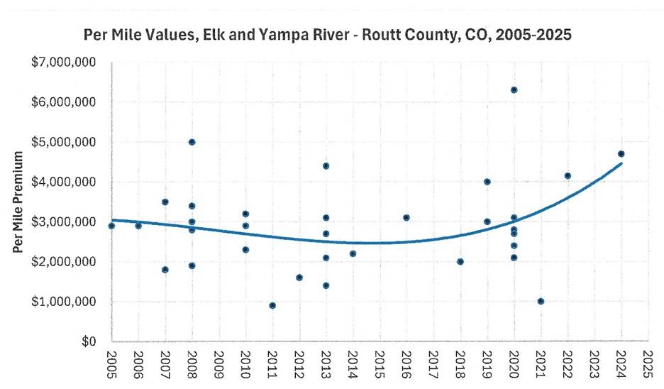
It should also be noted that stream mileage in Colorado in recent years has appreciated much faster than property values in general, even mountain ranch properties. Mileage on Tarryall Creek, for example, has gone from $400,000 per mile a decade ago to nearly $2 million today. Elk and Yampa River mileage has gone from $1 million a mile to $4.5 million in just 4 years.
Adjusting for inflation
An especially difficult part of the appraiser’s job is applying sales that are comparable in some details, but not in time. Since mountain ranches on the major Colorado rivers sell infrequently, estimates often must consider much broader geographic areas and analyze trends over a longer time period. As mentioned above, some of the comparable sales used for recent appraisals are 20 years old or slightly more. That makes the inflation adjustment more important than would be the case with ordinary real estate sales such as metro area homes where all the comparable sales are recent.
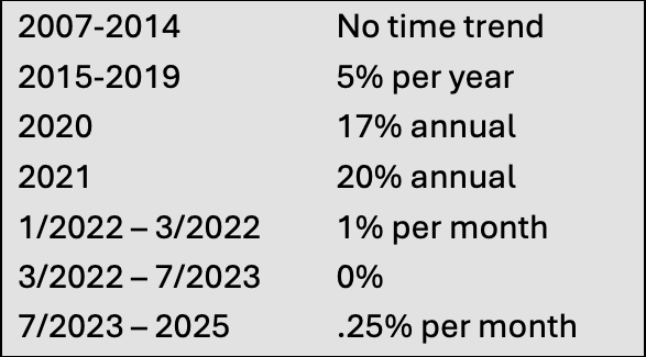
For this report, we relied on an inflation adjustment tool provided by the appraiser we worked with (see Appendix A for an explanation of the methodology), which is specific to farm and ranch properties in Colorado. On those property types, there was very little inflation between 2007 and 2015, then about 5 percent per year until 2019, a dramatic 17 percent spike in values in 2020 and 20 percent in 2021, and after that broken down by the month.
Using the raw data from sales of river and stream properties in Colorado since 2007, and applying the appraiser’s inflation adjustment tool above, we can closely approximate the value of privately-owned river and stream miles in 2026. With a desire to remain conservative in our estimates, we also used the most defensible conservative estimate of private river mileage as explained in the first part of this section, between 1,375 and 1,700 miles of privately-owned floatable streams. Assuming the average of just under $2 million per mile in value, as explained in the first part of this section, the value of those floatable miles is in the range of $2.75 billion to $3.4 billion.
That represents only the value of the stream itself, not including the potential lowering of adjacent land values if the river is not included. We have seen that in parts of Colorado the river mileage may be more than half the value of the land, sometimes as much as 85%, so taking away or diminishing that portion would certainly impact the remaining land value by making it less desirable in both tangible and intangible ways. It could also make many properties more difficult to sell, further weakening their value.
Perhaps less quantifiable but equally real is the prospect of diminished fisheries. As shown in the second report in this series, landowners spend tens of millions every year enhancing the habitat and augmenting the fisheries on their properties. Virtually all the landowners we spoke to assured us that they would make no further investments if the stream were no longer their property. That could affect the quality of fisheries for many miles upstream and downstream from the private land.
Finally, these assumptions do not include the value of mileage that is wadable but not generally floatable. If non-floatable miles of private waters were also implicated in a “takings” settlement, the cost to the state could be in the tens of billions or more.
Loss of Property Value
The previous section analyzed the value of river and stream mileage in Colorado, but if that property were taken for public use, that is far from the only economic impact. It must also be acknowledged that the value of the adjacent property would be diminished, in most cases significantly, and in many cases catastrophically. Consider the difference between ranchland that has no water and ranchland that has a river running through it. Aside from the value of water rights (an entirely separate issue, since the floating access issue does not affect Colorado water rights laws), the value of the river’s mere presence adds significantly to the property’s total value, for aesthetics, recreation, and especially fishing. That value is very high and increasing every year.
Because there is no database that lists every mile of river in the state along with specific acreages of adjacent properties, it is not possible to determine how much land would be affected by a public access law, and how much all those acres are worth. Nor can it be reliably estimated how much property taxes all those landowners pay each year and how much less they would pay if the value of those lands were thus diminished. But whatever that number might be, it isn’t zero. There would be a very significant loss of property value in every major river basin in the state, which would impact the revenue streams to varying degrees in most Colorado counties.
To show how land values are affected by river values, a few examples are useful:
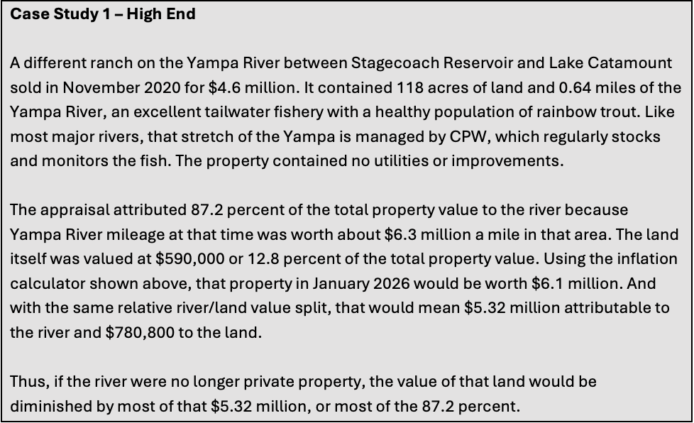
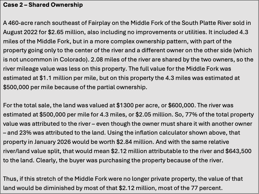
A complex conservation project in 2021 prevented subdivision along a 2.4-mile stretch of the Yampa River near Phippsburg. It added 476 acres to four previous conservation easements, protecting almost all of the Yampa River from Phippsburg to Stagecoach State Park, nearly 7 miles of river and 2,300 acres of land. The $268,000 cost of the project was shared by Routt County and Colorado Parks and Wildlife (CPW), with the owner also donating roughly half the value. The CPW contribution was made to gain public access for fishing and had to bear scrutiny from the state’s lawyers and auditors. A thorough appraisal was done to determine the value of public access to that stretch of the Yampa River. Eleven property sales over the previous decade were analyzed for land and river values, and the conclusion was eye opening – the river represented roughly 85% of the total value of the land. Looking at two of the comparable sales used at the time, and several others since, it turns out that is not unusual. Appraisals frequently attribute between 50% and 85% of the value of such properties to the river or stream. The following three case studies show the values on such properties, and the potential loss of value should private control be replaced by unrestricted public access.
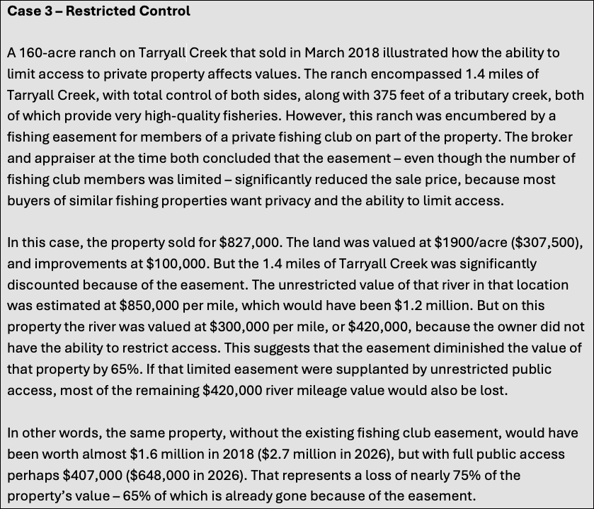
With each of these case studies, we relied on one of the state’s leading appraisers of this property type (see Appendix A), asking the same question many observers might ask: would taking private ownership of the river and making it public really reduce the value of the adjacent property 75% or more – even though the property still enjoys a scenic river on its border? The answer was mostly yes. Appraisers assign the value of private streams – often millions of dollars per mile, as we have seen – based on ownership and the property rights “bundle” that goes with it. That means the right to use and enjoy, to alter or improve, to change or even destroy, and especially the right to exclude others (See legal analysis, next section).
According to that expert and the dozens of examples we reviewed, appraisers generally assign substantially less value for the neighboring river, especially when it is accessible by anyone and everyone. He showed us several specific appraisal documents demonstrating that the purchase of public access by CPW, local land trusts, or others reduced the land value by virtually the entire amount of the stream value, not just part of it. Taking the private property value, in the eyes of real estate appraisers, takes most of the value otherwise attributable to the river as an enhancement of the property. The percentage of value remaining does include the river as a contributing factor, in the same way the view of a golf course might, though a substantially smaller contributor. These three case studies show that clearly, and they are representative of many other sales in Colorado over the past 20 years.
Intro to Legal Discussion
The issue of who has access to Colorado’s rivers and streams is not new to the State. 150 years of court interpretation and legislative efforts have resulted in a body of law that is well established even if it is not viewed by all as either fair or good policy, depending on your perspective. Several facts are not subject to interpretation. First, since statehood, Colorado has never designated a single stream or river as “navigable” for any reason. There are many far-reaching reasons for this. Concerns over implications to the State’s “prior appropriation” doctrine have made the state more than reluctant to cede any control to federal authorities regarding the administration of the State’s waters.
Second, and related, the “navigability” determination would implicate additional federal statutes like the Clean Water Act and Waters of the United States determinations. A determination that certain waters are “navigable” would trigger constraints on decisions that have evolved under state law to be entirely within the purview of State oversight; e.g. the determination of where and how headgates are located and administered. Third, and maybe most importantly, a “navigability” determination would require an extensive fact-finding, quasi-judicial process to determine whether any specific reach of water within Colorado was used for commercial purposes at the time of statehood. This daunting process would require administrative hearings, findings of fact and inevitable conflicts between interests hoping to establish public access on “navigable” waters versus maintenance of the status quo for non-navigable waters.
Advocates for expanded public access ignore or minimize the seismic legal shift that would be necessary to create either a statutory “right to float” or “right to wade.”[1] No legislation on either concept has been introduced or publicly vetted, but either proposal could include a right to portage on private property around hazardous obstacles. The “portage” concept would be a significant expansion of access over the current status quo.
Emmert
In 1979 the Colorado Supreme Court issued the seminal opinion regarding river and stream access in Colorado. In People v. Emmert, 597 P.2d 1025 (Colo. 1979) the State Supreme Court distinguished ownership of the water (which resides with the State) while allowing the right to use such water by individuals to put the water to beneficial use. This right to use is distinguished from the ownership of the stream beds and banks which are traditional private property subject to all the “bundle of rights” inherent in the ownership of such.
The Emmert Court specifically rejected the argument that section 5 of Article XVI of the Colorado Constitution conveyed the right to the public to float or wade on Colorado’s non-navigable waters. The Court also expressly recognized that there are no navigable waters in Colorado and therefore the three trespass convictions arising from the case were affirmed. The Court rejected the argument that the rafters had a constitutional right to “float and fish on a non-navigable natural stream as it flows through, across and within the boundaries of privately owned property without first obtaining the consent of the property owner.” Id. At 1026. The Court recognized that no court had ever recognized any of the state’s waterways as “navigable” as a matter of federal law. Id. With this foundation, the conclusion that traditional property rights governed riverbeds and banks was inevitable (citing Hartman v. Tresise, 84 P. 685, 687 (Colo.1906) (“the owner of lands along a non-navigable fresh water stream, as an incident of such ownership, owns the bed of the stream and the exclusive rights of fishery therein to the middle thereof; and if he owns the land bordering upon both sides, he has the exclusive right of fishing in the entire stream, to the extent that if flows through his lands”).
After Emmert was argued before the State Supreme Court but before the decision was issued, the Colorado General Assembly amended the criminal trespass statute to define “premises” as only pertaining to “the stream banks and beds” flowing through private property. C.R.S. 18-4-504.5. Thus, read together, Emmert and the amended criminal trespass statute precluded criminal trespass charges for floaters who did not touch the bed or banks of the rivers within the State. Left unaddressed was the question as to whether the same boaters (avoiding touching banks or bed) could be sued civilly for the same action. This last question has never been litigated to conclusion.[2]
Woodard
In 1983, at the request of then DNR Executive Director Chips Barry, Attorney General Duane Woodard issued a formal opinion regarding interpretation of the Emmert Decision and the legislative amendment which effectively excluded “water and air” from the definition of “premises” in the state’s criminal trespass code. 18-4-504.5. While Woodard’s opinion presents no binding legal authority and has been questioned extensively as to whether the opinion is, in fact, correct – the opinion has largely been relied upon in practice and effectively articulates the assumed law in the state regarding criminal liability for trespass on the state’s rivers and streams. Woodard takes a straightforward interpretation of Emmert and the subsequent amendment to the state’s criminal trespass statute to conclude that boats floating on rivers and streams will not be subject to criminal trespass provided they do not touch the banks or bed of the waterway. Woodard also concluded that landowners do not have the right to prohibit access to the surface of the river or stream. This latter conclusion is most often contested and has led to conflicts on several occasions over the intervening decades.
Woodard’s opinion did not touch on civil liability for floaters, and that question (as stated above) has never been addressed or resolved by courts in the State. The question of civil liability for trespass is probably more relevant to the duty of care owed by a landowner to someone who is floating through their property than it is to whether a landowner can actually recover damages for civil trespass. The duty owed to trespassers (almost none) is very different than the duty of care owed to someone who has a right to be on your property.
The second issue not addressed by Woodard relates to the reality of rafting any of Colorado’s rivers or streams. The ability to float a river and NOT touch any streambed, boulder or bank is, as a practical matter, virtually impossible. Notwithstanding this fact, landowners and rafters have taken a more realistic approach to the dilemma by largely ignoring what can best be called “incidental contact.”
Hill
The most recent flurry of litigation involving river access in Colorado has centered around the concept of asserting “navigability” and who has the right to make such claims. In 2023, the Colorado Supreme Court ruled unanimously that Roger Hill, an angler on the Arkansas River, did not have standing to assert navigability at the time of statehood. The Court concluded that only the State of Colorado had standing to make such an assertion and that the State had never made such an assertion.
In arguing for the State, Attorney General Phil Weiser laid out the reasons why individuals should not be allowed to make an assertion of navigability. Weiser pointed out the massive policy and legal implications that would result from ANY attempt to declare Colorado’s rivers and streams as navigable. Such an assertion would “upend these nearly 150 years of transfers and agreements” and would inevitably require a “comprehensive process” to explore commercial activity on various rivers and streams throughout the state to establish a factual basis for commercial activity on the waterways at the time of statehood. Such a process, asserted Weiser, “could have monumental consequences for water rights in Colorado and could lead to significant litigation challenging existing property rights.”
Bill to create right to float or wade
Although proponents of expanded access to Colorado’s waterways have not publicly shared any draft legislation, it is reasonable to assume that such legislation would propose a process for determining commercial navigability (or non-navigability) at the time of statehood. As pointed out by Attorney General Weiser, such legislation (which would likely mirror the process established by New Mexico) would create a quasi-judicial hearing process for access proponents and private landowners to present evidence on specific stretches of river across the state. New Mexico was in the middle of just such a process when the New Mexico Supreme Court stopped further proceedings. New Mexico utilized the state game commission as the venue for such hearings. The idea of burdening the Colorado Parks and Wildlife (CPW) Commission (or any other state body) at this point in time is untenable. The administrative burden (including the time and resources) and the management of a conflict of this magnitude would place the agency in another no-win situation and divert resources from other mission-critical challenges.
Presumably river advocates would petition to have certain segments of rivers deemed navigable and this would trigger initiation of the hearing process. Attorneys would be retained and evidence of commercial activity in 1876 would be submitted to a hearing officer or body charged with making findings of fact. Likewise, landowners would retain counsel and marshal facts to rebut such evidence of commercial activity submitted by the proponents of expanded access. This academic and historical “look back” would be very difficult to manage as “evidence” from 150 years ago would be debated and the reliability of such information would undoubtedly test the finder of fact’s ability to discern what activities actually took place on a waterway far in the past. The initial conclusion would be subject to judicial review and the record created by the parties would then be re-litigated at the appropriate District Court on administrative appeal. The number of cases is unknown but the cost to the state (just to conduct the process) and to the parties would be exorbitant.
Possibility for Takings Claims
Even assuming that a statutory change and resulting administrative process for determination of “navigability” was successfully pursued, the end result would be immediately challenged under the takings clauses of both the state and federal constitutions. Proponents of the expanded access law would have to explain how a significant reduction in the rights acknowledged to exist for 150 years has not resulted in a compensable taking. This is not a hypothetical or academic issue. Landowners have passed title for a century and a half expressly conveying ownership for the bed and banks of rivers that run through their property. The compensation paid in acquisition and sale has reflected the value of the bed and banks and the right to limit access to those streams. The right to prohibit touching either the bed or banks was specifically addressed in Emmert and acknowledged to be a property right. To the extent that C.R.S. 18-4-504.5 purported to allow floating on the same rivers (provided the bed and banks were not touched), it did not change the still unsettled right of landowners to pursue civil trespass against those floating through their property. The undisputed property interests for 150 years include an absolute right to prohibit touching the river’s bed or banks. Any attempt to limit these property rights by statute will trigger takings claims on any river where these established rights are diminished.
Justice Carrigan, in his Emmert dissent, expressly articulated the challenge to any attempt to expand the right to float by statute. “Ironically the majority opinion, while implying the General Assembly is competent to change the rule adopted today, has complicated the prospects of having the rule changed in the future. The Court has painted the state into a corner, and its brushwork assures that any effort to alter the rule will be difficult and expensive. The Court, by creating a vested property right in stream water (with a concomitant right to exclude all others from that water), has created a valuable property interest. And the General Assembly, therefore, cannot give the public recreational access to the rivers without taking away from landowners their newly recognized property interests and paying them “just compensation.” U.S. Const., Amendment V; Colo. Const. Art. II, section 15.”
The Emmert majority would, no doubt, assert that they didn’t “create” a new right but rather articulated the right which existed since statehood. The only disagreement on this point between the majority and the dissent is whether the right to exclude has existed for 150 years (statehood) or “only” 50 years from the time of the Emmert decision. For purposes of a takings analysis, this is a distinction without a difference.
Whether proponents of expanded access agree with Emmert or not is irrelevant. Emmert expressly acknowledged a significant property interest and a material infringement on those rights will almost certainly support a takings claim for impairment of those rights. As described earlier in the report, the value of rivers, their beds and banks add significantly to the value of property in Colorado. Landowners who have paid handsomely for this property interest (including the right to prohibit access to the bed and banks) will justifiably assert that the value of their real property has been materially reduced by creating a right to expanded access for the public.[3]
The value gained from those investments will also be materially reduced if the public is granted broader access to what has historically been private property. The United States Supreme Court has held that the “right to exclude” is a fundamental element of private property and falls within the category of interest that cannot be taken by any government without compensation. Cedar Point Nursery v. Hassid, 594 U.S. 139, 150 (2021).[4] Any legal contrivance implemented by legislation to find navigability would fail the takings test because Emmert expressly acknowledged the property right such legislation would undermine.
Montana and New Mexico
Advocates of expanded river access point to Montana and New Mexico as examples of successful rollbacks of private property rights. An historical and legal review shows that these examples actually show why these efforts in Colorado cannot be pursued successfully.
In 1972, Montana adopted a constitutional provision (Article IX, section 3) which “restated” the law that had always been recognized in the State. This provision specifically claimed ownership of the state’s waters and in 1984 the Montana Supreme Court interpreted this provision to convey use to the public without regard to streambed ownership or a determination of navigability for commercial purposes. Coalition for Stream Access, Inc. v. Curran.
In essence, the Montana Supreme Court, interpreting the Montana Constitution, reached a diametrically different conclusion than the Colorado Supreme Court interpreting the Colorado Constitution in Emmert. Access advocates may wish the Colorado Constitution, as interpreted by Emmert, provided the same rights to the public as the Montana Constitution but the well-established legal precedents interpreting their respective constitutional provisions simply cannot be ignored or reconciled. Colorado’s Constitution, as interpreted in the Emmert decision, does not provide access to the streambeds or banks of waterways within the State.
Similarly, New Mexico is often referred to by right to float/wade advocates as a model for Colorado to follow. A closer review of New Mexico’s situation and legal history points to an opposite conclusion. In 1945 New Mexico’s State Supreme Court ruled in State ex rel. State Game Commission v. Red River Valley Co. that New Mexico’s State Constitution provided that all natural resources belong to the public regardless of any determination of navigability. Thus, the public has a right guaranteed by the New Mexico Constitution to float on all rivers and streams including those running through private property. In 2015, the New Mexico legislature attempted to limit the right to float to only those navigable waters within the State and established a process (similar to the one discussed above) to allow the New Mexico Game Commission to conduct navigability hearings and allow for landowners to petition to have their rivers deemed non-navigable and thus exempt from the established right to float. During that process, the Commission found that 5 rivers reviewed under this process were non-navigable and therefore landowners on these stretches of river could preclude the public from floating on these waterways.
The New Mexico Supreme Court granted certiorari to a case brought by river access advocates to nullify these determinations and the Supreme Court unanimously agreed with the public access plaintiffs. The 2022 decision in Adobe Whitewater Club v. State Game Commission, the New Mexico Supreme Court cited the Red River Valley decision as providing for the very public access that the 2015 legislation sought to undermine through the subsequent Game Commission hearings and decisions. Because the Court determined that the Red River Valley decision found that the New Mexico Constitution guaranteed public access, the 2015 legislation providing for a means to restrict such access violated the state constitution, and the Red River Valley decision interpreting said constitutional provisions.
Colorado’s legal history is diametrically opposite. The Emmert decision found no such right of public access to the state’s waters and held that landowners expressly retained the right to prohibit any touching of the state’s riverbeds and stream banks. Any attempt by the Colorado Legislature to limit the property rights of the state’s landowners to limit or preclude public access (which has been in place for almost 150 years) would therefore be subject to a takings claim under both the State and Federal Constitutions.
Conclusion
This report’s purpose is not to advocate for or against any public policy change. Nor do the authors presume to predict how any legislative debates, ballot initiatives, or court challenges might eventually be resolved. Rather, our purpose is to inform opinion leaders and policy makers with a clear understanding of the vast amount of private property potentially affected, its staggering monetary value, the legal minefield involved in almost any proposed change in the law, and the onerous impact on property values and public resources.
Proponents of changing Colorado law regarding public stream access generally take one of two approaches: either creating an unlimited right to float, or a public right to float and use the streambeds and banks as well.
Declaring only a public right to float may sound more innocuous, and perhaps closer to existing law, but it has potentially far-reaching implications for civil trespass law and would represent a significant change in liability. If the landowner is largely protected from liability because the public has a right to recreational use (as is the intent of Colorado law in cases such as trail easements), then liability for injury or damage may be transferred to the public (the state). However, owners may still be held liable for hidden dangers that they knew about, so there could be considerable liability issues for both landowners and the state.
Declaring a public right to float that includes the right to wade, portage, and scout implicates substantially more miles of rivers and streams and thus potentially far greater impacts on property values. Following several months of conversations with property owners across the state, it is possible for the authors to say definitively that such changes in the law would lead immediately to litigation, possibly in both federal and state courts, since both the federal and state constitutions contain strong “takings” provisions.
Predicting how such proceedings may be adjudicated would be pure conjecture, but it is at least safe to expect such litigation to be lengthy, complex, and very costly. Indeed, it would be irresponsible not to at least acknowledge that litigation would be certain.
That could upend 150 years of settled law and precedent in Colorado, and reverse the understanding of generations of property owners, families, buyers, sellers, and investors.
Our first report in this series explained how and why the laws in Colorado developed over time, and exactly what the legal status is. The second report examined the way private landowners manage their stream properties, including hundreds of millions invested in stream and habitat improvements that benefit both the owners and the public. The conclusion of those reports was that Colorado’s unique approach to landowner-floater conflicts, based on case-by-case mediated agreements, may be the best solution to situations that differ markedly in different parts of the state. We identified several weaknesses in available information and called for creation of a better database and information system that outdoor recreationists could use to avoid conflicts.
We conclude this report by acknowledging that changes in Colorado law may precipitate a cascade of unforeseen consequences and invite a host of difficult-to-resolve issues. Policy makers may find it preferable to address information and system deficiencies mentioned in the first reports and continue to expect solutions through mediated agreements to resolve individual situations.
End Notes
CPW 2025 Colorado Fishing Guide. https://coloradofishing.net/CPW_2025FishingBrochure.pdf?utm_source=chatgpt.com
Appendix A – Appraisal Methodology
Appraising the precise value of specific properties, and specific rivers and streams, is an inexact science because there is considerable variation. In the final analysis, value is always determined by willing sellers and willing buyers, so actual sales are the primary information used by appraisers to determine value of like properties. Fortunately, there have been many such property sales in recent years in Colorado, so considerable information is available.
In this report, we use specific numbers and data from research and documentation of specific sales, not computer modeling. We relied at least partly on research and counsel from one of the Rocky Mountain region’s most respected appraisers of mountain ranch properties, whose specific experience and expertise includes appraising the value of rivers and streams. Kevin McCarty of McCarty Land and Water Valuation, Inc., based in Berthoud, has been an appraiser for over three decades for local, state, and federal government, land trusts, lenders, irrigation companies, attorneys, realtors, and property buyers and sellers. His projects have involved both fee title acquisitions and conservation easements in 80 counties throughout the Rocky Mountains and High Plains, including Colorado, Wyoming, Kansas, Nebraska, and New Mexico.
Appraisals for such unique properties are complex and must meet rigorous standards, especially the Uniform Standards of Professional Appraisal Practice (USPAP). Appraisers must be licensed and certified by the Colorado Board of Real Estate Appraisers (Real Estate Division, Department of Regulatory Agencies) and must keep current on USPAP continuing education to follow any changes to the standards. There are also federal Treasury Department regulations that apply to conservation easements, and appraisers who work in this space, such as McCarty Land and Water Valuation, generally conform their research and reporting to Uniform Appraisal Standards for Federal Land Acquisitions. Specializing in rural properties such as ranches with rivers and streams often requires additional training, such as courses from the International Association of Assessing Officers, the Appraisal Institute, and the Society of Farm Managers and Rural Appraisers.
Appraisers determine value by applying one of three traditional approaches recognized under USPAP standards: the sales comparison approach, the income approach, or the cost approach. For rural properties such as mountain ranches with rivers and streams, the sales comparison approach is almost always the primary method. The appraiser examines recent sales of comparable properties, then makes detailed adjustments for differences, and for inflation if applicable. Those differences can include acreage, water rights, grazing capacity, timber, buildings and other improvements, access, conservation easements, topography, wildlife habitat, and proximity to markets or other amenities. With rural sales, as mentioned above, estimates often look further afield and through a longer period of time, carefully reconciling differences in highest and best use (working ranch vs. recreational retreat vs. development potential). Ultimately, the appraiser reconciles these analyses into a final opinion of market value that reflects what a typical, well-informed buyer would likely pay under current market conditions.
For this report, we used no speculative appraisals, only actual sales. These are the comparison sales that appraisers examine to determine potential values for future sales, and we relied heavily on Mr. McCarty’s research to provide many of those sales records. The sales themselves, including sale prices, are public records, but the appraisal reports may not be, so we are in his debt for sharing many of those reports, not only his own but those of numerous other appraisers, as well.
[1] For purposes of this analysis, “right to float” is shorthand for any attempt to codify the current status of Colorado’s river access law created by case law interpreting the Colorado Constitution and Colorado statutes. The “right to wade” proposed by some access advocates would be a dramatic expansion of current river access law entitling boaters and anglers to have the right to use the stream bed and banks up to the river or stream high water mark. It should be noted that previous attempts to “codify existing law” on the right to float actually proposed expanding the right to float. Any future proposal to allow for incidental contact (or portage) with the stream bed or bank is not consistent with the Emmert decision. Any statutory attempt to allow for incidental contact or portage would result in a loss of property rights currently held by landowners.
[2] The authors are only aware of one attempt to pursue civil trespass in the State’s history. That action was initiated over a rafting dispute on the Lake Fork of the Gunnison but the defendant in that action went out of business before any court had an opportunity to opine on the civil liability question.
[3] In addition to the compensation paid by landowner for the river’s beds and banks, as established in Report 2, many landowners have made massive investments in river quality and fish habitat.
[4]The Cedar Point Nursery Court affirmed that the right to exclude is “universally held to be a fundamental element of the property right,” and is “one of the most essential sticks in the bundle of rights that are commonly characterized as property.” Citing Kaiser Aetna v. United States, 444 U.S. 164 (1979).